History of Eastern Mojave & the Mojave Road
The Mojave Road: A Desert Path Through TimeThe Mojave Desert isnt just a wide, sun-blasted stretch of sandits a place people have moved through for centuries, seeking water, trade, and connection. Long before highways or railroads, a natural corridor of springs and washes led travelers across this dry land. That path is what we now call the Mojave Road.
Originally used by Desert Indians, this route was a lifeline for Spanish missionaries, American explorers, traders, and eventually, the U.S. Military.
Following the Water
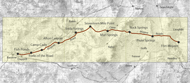
In the desert, everything revolves around water. While its plentiful on the California coast and at the Colorado River, the land in between is harsh. Fortunately, a string of springs Piute, Rock, Marl, and Soda made it possible to cross this wilderness. These points became the backbone of a natural travel route.
Indigenous Trails and Traders
Before any foreign explorers arrived, the Mojave Indians used this route to carry goods from the Colorado River to coastal tribes like the Chumash. They were known as strong desert travelers and savvy traders.
As you moved westward, you entered Chemehuevi territory. Even earlier, cultures like the Anasazi left their mark here through turquoise mining and trade networks. Many different tribes traveled the Mojave Road over the centuries.
Garces and the First Written Account
One of the first written descriptions of this trail comes from Father Francisco Garces in the 1770s. A Spanish priest traveling from Arizona to California, Garces wrote about the Jamajab (Mojave) people who welcomed him with respect and curiosity. They knew the way across and offered to guide him. Garces admired their toughness, noting they could go days without food or water.
Fur Trappers and First Conflict
In the 1820s, Jedediah Smith and other fur trappers passed through. Smith made the crossing with help from Mojave guides. But not all groups were so respectful. One party clashed with the Mojave Indians, leading to bloodshed on both sides.
Beales Camels and Military Posts
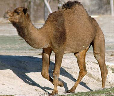
After the U.S. took control of California in 1848, the road became a military interest. Edward F. Beale led one of the strangest experiments: marching camels across the Mojave Road. The camels handled the desert finebut terrified horses everywhere they went.
By the time of the Civil War, the road became even more important. With Native resistance on the rise, forts were built to protect mail routes and supplies to Arizona. Posts like Hancocks Redoubt, Marl Springs, Rock Springs, and Piute Springs became key military outposts.
End of an Era
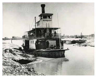
Soon, the roads importance faded. Steamboats pushed up the Colorado River and a railroad bypassed the route entirely by 1883. The old trail across the Mojave, once vital, was left to the wind and the memories of those who had walked, ridden, or fought along it.
Timeline of the Mojave Road
Prehistoric Times Indigenous peoples use the route to trade between the Southwest and California coast.
1776 Father Garces documents his crossing with Mojave guides.
1826 Jedediah Smith crosses with Mojave help; conflict with another trapping party follows.
1848 After the Mexican-American War, the U.S. gains the Mojave Desert.
1857 Beales Camel Corps travels the Mojave Road.
1860s U.S. Military builds forts to secure the route to Prescott, Arizona.
1883 Railroad between Mojave and Needles is completed; Mojave Road falls into disuse.
Archive page
Rudolph D'Heureuse