Mohave Indians
Creation
There was chaos in the beginning, and from the earth and sky was born the Great Spirit Matavilya. People sprang from Avi kwa' ame, the great mountain. But, Matavilya was killed by his sister, Frog Woman, before he could teach the people how to live. Little brother Mastamho took charge and with a willow stick he drew a line in the sand and the line became the river. With the river came the ducks and the fish, and Mastamho scraped the mud from the banks of the river and made the mountains.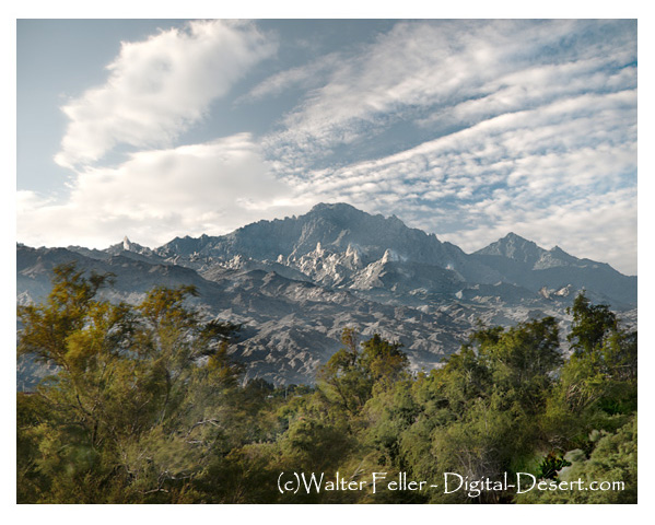
Aha Macav
The people knew nothing, and Mastamho showed the people everything, to know day from night, to plant, to build a fire and a house for shelter. He showed them how to hunt and fish, how to count and the four directions. And when the people learned to do these things, he gave them all he had created. The river and everything along it -- it was theirs, they were the Aha Macav, the people who live along the water.Territory
Three groups, made up the Aha-Macav along the Colorado River, mostly in the area where the states of Nevada, Arizona and California come together.The northernmost group was the Matha lyathum, who lived in Black Canyon south to the Mojave Valley.
The Hutto-pah inhabited the central Mojave Valley.
The Kavi lyathum occupied the area south of the Mojave Valley to below the Needles Peaks.
Aha Macav
The dream world to the Mojave, was just as real as the physical world. Through dreams they could travel back to the time of creation and learn the meaning of things. They could learn of gifts they had been given. Powers and abilities certain men had been given to heal or lead in battle. These people would fast for days and prove true to tests designed to verify their talents and receive their visions.The tall men would walk naked and cake their hair with mud, twisting it into shapes. The beautiful women would wear rabbit and beaverskin capes. They practiced face tattooing and painting. The spirit of a Mojave who died without face tattoos would go into a rat hole in the ground and remain. They would tattoo their captives and slaves with marks of ownership.
The Colorado River
Their life centered around the river. They relied on annual overflow to irrigate their crops of melon, corn, pumpkin and beans. They would gather mesquite beans as wells as other wild seeds and roots. They would use traps and nets to take game and fish from the river. They were traders, and would follow the trails as far as the Pacific coast to obtain items that were not available to them in the desert.Warriors in Battle
They could defend their territory with great fierocity. They were brave in battle. War parties could travel hundreds of miles, living on chia seeds and water. They fought with clubs, hitting the tops their enemy's heads driving them down, then swinging up to crush their jaws. They would take scalps and prisoners. Captives would later be sacrificed to serve fallen warriors in heaven. They would follow the warrior master's spirit up Avi kwa' ame, the way to heaven, the Spirit Mountain. They would purify themselves before returning home, so that dark spirits would be lost and not follow them.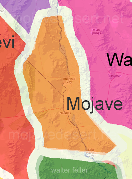
Mojave Ethnography
People by the Water
Edward Curtis Photo Callery
Origin of Amboy Crater
Photo tours of Mojave TerritoryGrapevine Canyon
Topock Marsh
Topock Gorge
Mystic Maze
Hum-Me-Chomp
also see...
Colorado River
Needles, CA
Havasu WR Bird Lists
People
Fr. Fransisco Garces
Jedediah Smith
Olive Oatman
Edward F. Beale
Associated Tribes
Chemehuevi
Havasupai
Hualapai
Yavapai
Wilderness Areas
Chemehuevi Mountains
Bigelow Cholla Garden
Dead Mountains
Old Woman Mountains
Stepladder Mountains
Turtle Mountains
Related
Petroglyph Information
Photos of Petroglyph Sites
Route 66