Tübatulabal Indians
The home of the Tübatulabal lay on the main and South Branches of the Kern River, their territory thus extending
up the former to its headwaters in Sequoia Park. This was, however, too high to be settled permanently and served
as no more than summer hunting territory. It is likely that
Western Mono
and possibly some Yokuts also visited
this section, so that its assignment to the Tubatulabal follows mainly from its greater accessibility to them.
The Tubatulabal spoke an isolated
Uto-Aztecan
language. The degree to which the Tubatulabal language diverges from
its Shoshonean kin shows that these people have been more or less isolated in their mountain home for a considerable
period. However, in most respects their traditional culture was more similar to that of central California groups,
such as the Yokuts, than to that of the Tübatulabal's Great Basin relatives.
Tubatulabal traditional narratives include myths, legends, tales, and oral histories preserved by the Tubatulabal
people of the Kern River basin of the southern Sierra Nevada in California.
Tubatulabal oral literature was most similar to that of the Great Basin, rather than central California.
They were on friendly terms with their various neighbors on the western slope of the Sierra whom they often
visited, and even joined during certain seasons. The legend that they raided the peaceable valley
Yokuts
from
time to time is therefore pure fancy, without foundation.
Tubatulabal is a
Shoshonean
term meaning "pine nut eaters".
Their former population may have numbered 1,000. In 1925 there were 100 to 150.
Ecosection M261E - Sierra Nevada
Tübatulabal Indians
The Tübatulabal are a Native American people who historically inhabited the southern Sierra Nevada region of California, USA. Their traditional territory is in and around the Kern River Valley. The Tübatulabal people are part of the larger Uto-Aztecan language family.
Historically, the Tübatulabal people lived a semi-nomadic lifestyle, relying on hunting, fishing, and gathering for sustenance. They had a deep connection with the natural environment and utilized the resources available in the mountainous region where they lived.
Like many Native American groups, the Tübatulabal experienced significant disruptions and challenges with the arrival of European settlers in the 19th century. The impact of diseases, loss of land, and changes in their traditional way of life had a profound effect on their population and cultural practices.
Today, efforts are made to preserve and revitalize Tübatulabal culture and language. The Tübatulabal people, like many Native American groups, work to maintain their cultural heritage and traditions while also adapting to the contemporary world.
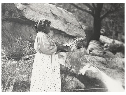 Tubatulabal woman
Combined Ethnography
Introduction & OverviewTribal Distributions
Subsistence
Weapons, Houses, Clothing
Pottery
Basketry
Cradles
Other Weaving
Musical Instruments & Misc.
Tobacco
Transportation
Trade
Games
Social Organization
Money
Other Social Customs
Ceremonialism
Archaeology
Bibliography
David Earl - California State Parks
Antelope Valley Indian Museum