Natural and Cultural Settings in the California Mojave
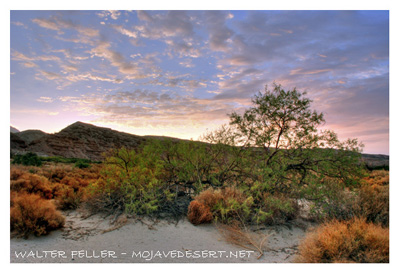
*NATURAL SETTING*The Mojave Desert begins directly south of one of the few surface manifestations of the Owens River along its course to Los Angeles, an area known as Little Lake. From here, the Mojave Desert spreads west, following the southern Sierra Nevada Mountain Range to the Garlock Fault, and south to the San Andreas Fault and the Transverse Mountain Range. For this project, the California-Nevada boundary serves as the eastern boundary of the Mojave Desert, but in reality the Mojave Desert continues east into Nevada for a considerable distance (Latting and Rowlands 1995:27). In addition to its lower elevation than the Great Basin, the numerous north-south trending mountain ranges in the Mojave Desert block the eastward movement of moist air from the Pacific Coast. The mountain ranges cast a rain shadow over the desert, resulting in lower annual rainfall (Moratto 1984:340). Between these mountain ranges are broad desert lowlands and playas, which are characterized by sand, gravel basins and desert pavement. In some areas, particularly those where the Owens River once coursed, ephemeral, salty lakes appear following flash floods and downpours (Moratto 1984:17). Currently, the only river found in the project area is the Mojave River. The Mojave River forms in the San Bernardino Mountains and flows as a permanent stream to the base of the mountains. For the next 100 miles, the river is normally dry on the surface, except where the river occupies a bedrock gorge (for example, Afton Canyon or near the city of Victorville). In California, the western Mojave Desert encompasses Kern, Inyo, San Bernardino and small segments of Los Angeles and Riverside Counties.
While the California Desert is currently characterized by its lack of water, its earliest inhabitants enjoyed a cooler and moister climate. Numerous lakes could be found in the valleys that now contain dry lakes and saline ponds. Between 12,000 and 8,000 years ago, Native American settlements in the California Desert were centered on lakes, where the marshy shorelines provided Native Americans with food and the materials necessary for making tools, clothing and shelters (USDI, BLM 2003:63). During the earliest stages of settlement in the Pleistocene, the desert was characterized by Joshua trees, pinyon pines, sagebrush and juniper trees, which spread over much broader and lower expanses than they do today (USDI, BLM 1999:3).
Between 8,000 and 6,000 years ago (USDI, BLM 2003:63), a warming trend led to the drying of Pleistocene lakes and the retreat of the aforementioned plant communities to higher elevations (USDI, BLM 1999:3). This drying trend caused a shift in settlement patterns of Native Americans and necessitated constant travel that was oriented around vegetal resources, game and increasingly sparse water sources. Also during this time, plants that are common today, including creosote, saltbush, palo verde and cacti, https://mojavedesert.net/cactus/ began to dominate the desert. Other plant communities continued their retreat to areas around springs, marshes and stream beds (USDI, BLM 1999:343).
The present vegetation is dominated by creosote, phacelia, seasonal grasses, saltbush, burrobush, cholla and beavertail cacti, and the occasional Joshua tree. Lizards, rattlesnakes, rabbits, rats, coyotes, and foxes are the most common reptiles and mammals, while common birds include the Sage Sparrow, Cactus Wren, roadrunner and quail, to name a few. As mentioned previously, the Mojave Desert is characterized by its extreme aridity caused by a rain shadow effect. Annual rainfall amounts to around 10 to 15 centimeters (Stickel 1980: 19-20). Today, the western Mojave Desert is also characterized by expanding towns and cities, which began appearing in large part after World War II. Highway settlements, resort towns and other modern conveniences and attractions began to appear around this time. This expansion of large populations into the California Desert necessitated the construction of additional water projects, highways and long-distance transmission lines in the fragile desert ecosystem. The California Desert is now home to over one hundred desert communities, nine military bases and their testing grounds and the infrastructure to support these communities (USDI, BLM 1999:4).
*CULTURAL SETTING*
*Prehistory*
The prehistory of the West Mojave Area spans four general temporal periods: Late Pleistocene and Early, Middle, and Late Holocene. In light of the many cultural sequences, the temporal periods are described below.
*Late Pleistocene (20,000 � 10,000 BP)*
Despite some claims for very early human occupation within the Planning Area (Davis et al. 1980), the earliest well-documented evidence is found in the form of the distinctive fluted Clovis-style projectile points that have been found at scattered locations throughout the region (Rondeau et al. 2007). Because these points are typically found on the surface and are not associated with radiocarbon assays, the dating of these early occupations remain problematic. However, Olivella shell beads from several sites within the Planning Area, including the Stahl Site in Inyo County, one site in Riverside County and four sites in San Bernardino County (Goldstone, Awl Site, Rodgers Ridge and Flood Pond), have yielded radiocarbon dates with the Late Pleistocene range. These sites were located adjacent to lakes or marshes and often contain a variety of artifacts such as scraping tools, leaf-shaped bifaces and associated debitage (Erlandson et al. 2007; Fitzgerald et al. 2005). Based on the relatively high frequency of points and scrapers, these early groups have traditionally been seen as mobile big-game hunters; however, recent studies suggest that their economies were more diverse and focused on smaller animals and plants, with large game playing a minor role (Erlandson et al. 2007). They are believed to have lived in small populations in temporary camps located near permanent water sources (Sutton et al. 2007).
*Early Holocene (10,000 � 7,500 BP)*
In general, the transition from the terminal Wisconsin to the Early Holocene within the Mojave Desert was characterized by somewhat warmer and increasingly drier conditions. Pluvial lakes, while still present in the region, were generally retreating and had dried completely by around 8,000 years ago. Human use of the desert is manifested by the Lake Mojave Complex, which occurred between approximately 10,000 and 8,000 year ago, and is characterized by projectile points of the Great Basin Stemmed series and abundant bifaces, steep-edged unifaces, crescents, occasional cobble-core tools and groundstone implements. Sites attributed to the Lake Mojave Complex have usually been found only as surface deposits and lack materials suitable for dating. However, some radiocarbon dates have been obtained for sites at Lake Mojave, Fort Irwin, Twentynine Palms, Rosamond Lake and China Lake (Sutton et al. 2007). These sites are frequently found on the shorelines of pluvial lakes. Site types include residential bases, lithic workshops and small camps, and settlement patterns are seen as highly mobile, with small social units visiting resource patches on seasonal rounds. Faunal remains have been found in limited quantities at Lake Mojave sites, but evidence from excavations at Fort Irwin suggest hunting focused on small game, reptiles and rodents (Sutton et al. 2007).
*Middle Holocene (7,500 � 4,000 BP)*
During the first part of the Middle Holocene, a drier climate resulted in a sporadic and relatively short-duration appearance of shallow desert lakes. Researchers have posited that during this period settlement within the Mojave Desert, there was a focus on upland contexts along remnant pluvial lake basins, channels and at spring/seep locations. During the early part of the Middle Holocene, the Pinto Complex (7,000 to 4,000 BP) appeared in the area encompassed by the Planning Area. Radiocarbon dates from some sites in the Mojave Desert suggest that there was an overlap between the Lake Mojave and Pinto complexes and that the Pinto Complex may have begun in the Early Holocene (Sutton et al. 2007). The artifact assemblages include Pinto points, leaf-shaped points and knives, drills, heavy-keeled scrapers, retouched flakes, choppers, hammerstones and shell beads. Manos and flat milling stones also appear in abundance for the first time in the Mojave Desert. Based on this high abundance of milling tools, intensive plant exploitation was one of the inhabitants� subsistence strategies and access to plant resources must have been an important factor in determining site placement (Sutton et al. 2007). Groups most likely consisted of multiple families living in centralized sites logistically close to locations used to gather resources (Sutton et al. 2007).
*Late Holocene (after 4,000 BP)*
Following an approximate 1,000-year period of reduced occupation in the Mojave Desert, the Gypsum Complex (approximately 4,000 to 2,000 BP) emerged amid the somewhat wetter and cooler climatic conditions of the Late Holocene (Sutton et al. 2007). The artifact assemblage characteristics of Gypsum sites consist of Elko, Humboldt and Gypsum Cave projectile points; triangular knives; large points with straight bases and shoulders; hammerstones; choppers; flake-based scrapers; scraper-planes; large drills with expanding bases; stone pendants; limited shell beads; millingstones; manos; mortars and pestles (Warren 1984). Faunal remains from Gypsum sites indicate hunting focused on artiodactyls, lagomorphs and rodents (Sutton et al. 2007).
Prehistoric sites and features with diagnostic elements indicate use of the Darwin area from at least the Newberry Period (ca. 4,000 to 1,350 BP) through contact, though the potential for evidence of earlier occupation exists in several sites where subsurface deposits have been identified and remain undisturbed. During the Newberry Period in Owens Valley and the Eastern Sierra, the area was characterized by highly mobile groups, caches of Elko and Humboldt Basal notched points, bifaces and milling equipment (Eerkens and Spurling 2008; Faul 2006). Sites dating to the latter part of this period are typically base camps with structures and lithic reduction sites. Obsidian quarrying reached its peak during this period (Eerkens and Spurling 2008). Sites occur more in the Volcanic Tablelands and northern Owens Valley than in the southern Owens Valley area (Paulson 2009).
The Late Holocene from about 1,500 BP to the time of the historic era is viewed by most archaeologists as the extension of the ethnographic present. A series of dry and wet episodes characterize the climate during this period (Larson and Michaelson 1989; Sutton 1996; Weide et al. 1974). Lakes in the Mojave Desert started to dry up and site locations were centered near ephemeral water sources during the latter part of this period.
The Rose Spring Complex during the latter part of the Late Holocene (1,500 to 1,000 BP) marked the beginning of the bow-and-arrow technology in the Mojave Desert. These sites have well-developed middens and a variety of material culture, including Eastgate and Rose Spring projectile points, stone knives, drill pipes, bone awls, milling tools, marine shell artifacts, and large quantities of obsidian (Sutton et al. 2007). The sites are found near springs (Saratoga, Rose) along washes and sometimes along lakeshores (Rogers/Rosamond and Koehn Lakes). Evidence of wickiups and pit houses has been found in two sites in the western Mojave Desert (Sutton et al. 2007).
In the Owens Valley, sites dating from 1,500 to 600 BP (identified in regional chronologies as the Haiwee Period) show evidence of more sedentary groups with semi-subterranean houses. The bow and arrow (Rose Spring and Eastgate points), and store pits are introduced, and artifact caching mostly disappears, with production at obsidian quarries also dropping off (Eerkens and Spurling 2008, Faul 2006). The band-like structure is replaced by the household as the primary (Paulson 2009). Subsequently, (600 BP to contact), Marana Period Cottonwood, Desert Side-notched points and Owens Valley brownware (a coil and scrape type of construction) are introduced and there is an increase in groundstone tools as the harvesting of green pinyon pine nuts becomes a subsistence focus (Bettinger 1989; Eerkens and Spurgling 2008).
-- Mary Pfeiffer Archaeological Crew Chief, WEMO Bureau of Land Management, Barstow Field Office
-- *Rose Beardshear* *Bureau of Land Management* *Barstow Field Office
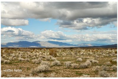
Fremont Valley (Garlock Fault)
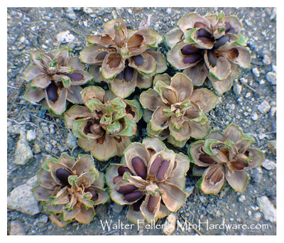
Pinyon pine nuts in cone
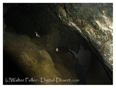
Newberry Cave
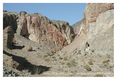
Afton Canyon
Mesquite in Afton Canyon
Transverse Ranges (San Gabriel Mountains)
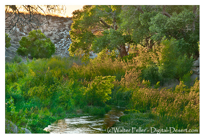
Mojave River, Lower Narrows

Mojave River, Upper Narrows