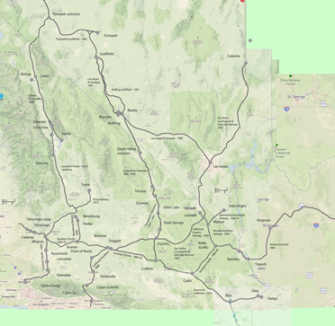
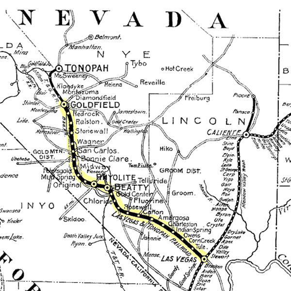
Las Vegas & Tonopah Railroad
The Las Vegas and Tonopah Railroad was a desert railroad built during the Nevada mining boom of the early twentieth century. It was incorporated in 1905 by interests associated with William A. Clark and constructed northwest from Las Vegas toward the gold camps of Beatty, Rhyolite, and Goldfield. The line was intended to tap the rich mining traffic of southern Nevada and to secure a direct connection from the Los Angeles and Salt Lake Railroad at Las Vegas into one of the West's most active mineral regions. In full form, the railroad extended about 198 miles from Las Vegas to Goldfield, making it a substantial desert line rather than a minor local spur. It reached Indian Springs in March 1906, Rhyolite by December 1906, and was completed through to Goldfield in November 1907.Its purpose was both strategic and commercial. The railroad was built to carry ore, mining machinery, fuel, building materials, mail, passengers, and general freight into and out of the boom districts. In the years immediately after construction, the line served communities whose rapid growth depended on reliable rail transportation across remote and water-scarce country. The route passed through classic desert railroad territory, including Tule, Indian Springs, Amargosa, Beatty, Rhyolite, Bonnie Claire, and finally Goldfield. Like many mining railroads, its economic strength depended heavily on the continued productivity of the camps it served.
The railroad's life was relatively brief. The northern end between Beatty and Goldfield operated only until 1914, after which that portion was removed. Service south of Beatty continued for a few more years, but declining mining traffic undermined the line's reason for existence. Daily train service lasted until February 1, 1917, after which operations were reduced, and by 1918 to 1919 the remaining line was abandoned and scrapped. Despite its short life, the Las Vegas and Tonopah Railroad remains a characteristic example of a western mining railroad: ambitious, quickly built, closely tied to boomtown economics, and ultimately undone by the same instability that had justified its construction.
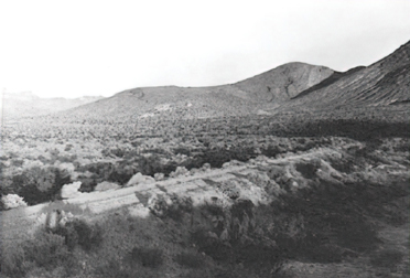
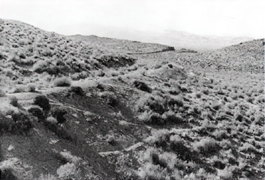
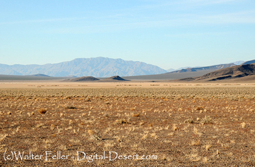
55. Las Vegas & Tonopah railroad grade
56. Las Vegas & Tonopah railroad grade
Illustrations 55-56. Top: Las Vegas & Tonopah Railroad grade, looking west towards the Original Bullfrog Mine from a point approximately one mile east of the Death Valley National Monument boundary line. The dumps of the Original Bullfrog are barely visible in the center background. Bottom: Portions of the railroad grade, looking southeast from the point where the Hometake-Gold Bar wagon road leaves the railroad, about 2 miles northwest of the Original Bullfrog. The grades in these two pictures are clearly marked, as they have been used for many years as auto roads. 1978 photos by John Latschar.
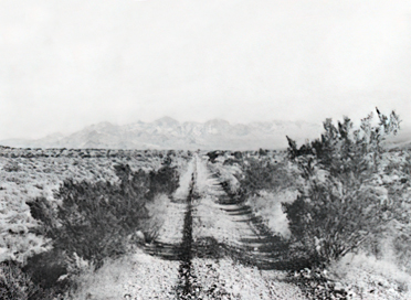
57. Las Vegas & Tonopah railroad grade

58. Las Vegas & Tonopah railroad grade
Illustrations 57-58. Top: A portion of the Las Vegas & Tonopah grade, looking northwest from Currie Well. Notice the fill in the background, and the cut through the small ridge in the background. Bottom: The grade runs straight as an arrow once it leaves the hills and valleys of the Bullfrog district. In this photo, taken two miles north of Currie Well, the road bed may be discerned as it meets the horizon in the background. This portion of the grade is less obvious, since it has not been used as an auto road. 1978 photos by John Latschar.
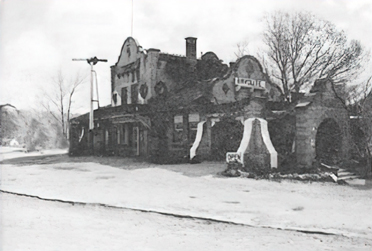
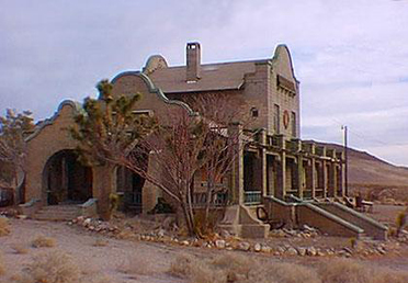
59. Las Vegas & Tonopah passenger station
Illustrations 59-60. Top and bottom: Front and rear view of the Las Vegas & Tonopah passenger station in Rhyolite. Since the demise of the railroad, the station has been used variously as a private residence, a casino, a gift shop, and a restaurant and bar. Although the structure is now in good condition, the present owner is very old, and local residents have no idea what will happen when she dies. Although the station itself is structurally intact, numerous changes have been made. The trees surrounding it, for example, were no more than seeds during the highlight of Rhyolite. 1978 photos by John Latschar.
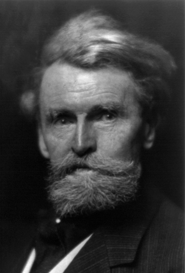
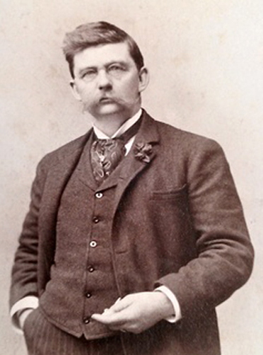
Senator Wm. A. Clark
Borax Smith
Bonnie Claire Lake
Rhyolite train station