Territory Boundaries
Claims Case Boundaries. Here we shall use the descriptions agreed to by the tribes themselves in suing for the reimbursement by the United States for depriving them of their traditional territory in the Claims Cases of the 1950s, even though these descriptions were and still are controversial.In the Claims Case, the Serrano claimed the following:
Beginning at a point approximately 5 miles East of the City of Redlands; thence Northwesterly in an irregular line to a point in the approximate area of the San Gabriel Range which is due North of Mt. San Antonio; thence Easterly in an irregular line along the San Gabriel Range to Cajon Pass; thence Northeasterly in an irregular line approximately 8 miles; thence Northeasterly in an irregular line to a point approximately 3 miles Northeast of the town of Ludlow; thence Southeasterly in an irregular line to a point approximately 1 mile Southwest of the town of Cadiz; thence Southeasterly in an irregular line to a point in the approximate area of the Big Maria Mountains, approximately 12 miles West of the Colorado River; thence Southerly parallel with and approximately 12 miles Westerly of the Colorado River Westerly in an irregular line to a point due West of Blythe; thence Westerly in an irregular line to the approximate area of the present Hayfield Reservoir on the Colorado River Aqueduct; thence Westerly in an irregular line following the line of said Aqueduct to a point approximately due North from San Jacinto Peak; thence South in an irregular line to the approximate area of San Jacinto Peak; thence Southeasterly in an irregular line to the approximate area of Lookout Mountain; thence Westerly in an irregular line to the approximate area of Coahuilla Mountain; thence Northwest in an irregular line to a point which is approximately 12 miles southwest from the point of beginning; thence Northeast in an irregular line approximately 12 miles to the point of beginning (U.S. Court of Claims 1950-1960: Docket No. 80).
The Maringa (Marińa) Serrano, one of the most visible of Serrano groups in the historical period, occupied the south easternmost reaches of this territory, and were the most important Serrano clan, at least in the 19th century, after many of the Serranos who lived nearer the coast were taken into Mission San Gabriel in 1811. After that, the remaining Serranos moved southeastward to escape the Mission system. The Serrano at Mara were members of this clan, probably a lineage thereof. Other members of the Maringa clan in the mid-nineteenth century lived at Yamisevul, also known as Maringa', on Mission Creek, and eventually joined Cahuilla relatives on the Potrero (on Section 36 of T 2 S, R 1 E, SBM, where the waters of Potrero Creek were used to irrigate fields.
From Mara Oasis, the Maringa probably traveled seasonally to harvest plants and to hunt over the vast ranges of the Mojave and Colorado deserts to the east and southeast, but the northeastern part of the territory described in the Claims Case was probably the territory of the Vanyume, a group encountered by Garcés in 1771, and after that not known to have been encountered by those passing through (Galvin 1967; Kroeber 1925:614).
<< Previous << Contents >> Next >>
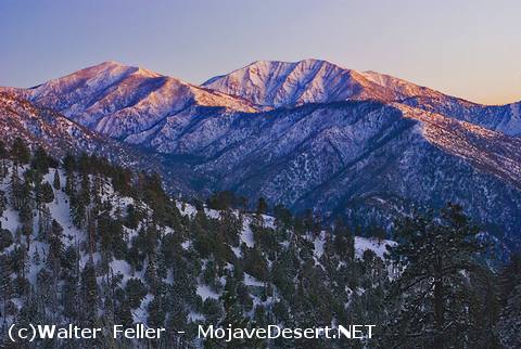
Mt. San Antonio (Mt. Baldy - far peak)
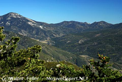
Heart of Serrano Territory (San Bernardino National Forest)
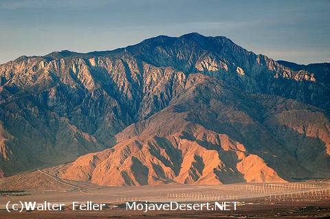 Mt. San Jacinto