TOP -- A B C D E F G H I J K L M N O P Q R S T U V W X Y Z
Canyon
A deep gully, caused by extensive persistent erosion relating to that typically of a river, or often in the case of the desert, a wash.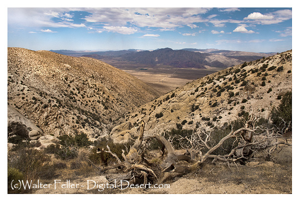
Also see: Wash
Usage:
-
Grand Canyon Pictures
The Grand Canyon is more than a great chasm carved over millennia through the rocks of the Colorado Plateau. It is more than an awe-inspiring view. ...
Red Rock Canyon
Red Rock Canyon receives nearly 1.2 million visitors every year, and is located 17 miles West of the strip on Charleston Boulevard (also shown as Highway ...
Death Valley's Fan Club - Golden Canyon - Death Valley
Golden Canyon preserves geologic stories steeped in change. Like pages in a book, its rocks tell tales of ancient times when a lake once covered this land; ...
Red Rock Canyon - Mojave California
Red Rock Canyon State Park features scenic desert cliffs, buttes and spectacular rock formations. The park is located where the southernmost tip of the ...
Grand Canyon Plants
There are approximately 1737 known species of vascular plants, 167 species of fungi, 64 species of moss and 195 species of lichen found in Grand Canyon ...
Grand Canyon natural environments
Natural environments and habitats in the Grand Canyon.
Grand Canyon Wildlife
Its large size, relatively unfragmented and diverse habitat, and range of elevations and associated climates have made Grand Canyon National Park a valuable ...
Grand Canyon Caverns
Grand Canyon Caverns, Hualapai Reservation Peach Springs, AZ, Arizona, Route 66, route 66 arizona, dinosaur caverns photos.
Last Chance Canyon
Manly and Rogers on their heroic walk to save a party of lost 49er's made their way through this rugged canyon. The name however, came from the gold-seekers ...
Big Morongo Canyon Preserve
Big Morongo Canyon is located in San Bernardino and Riverside counties, south of Yucca Valley, California. It begins about one-half mile southeast of the ...
Hiking trails in Red Rock Canyon
Hiking trail guide to Red Rock Canyon NCA near Las Vegas, NV.
Afton Canyon Area Satellite Image
SATELLITE > Afton Canyon
Grapevine Canyon Petroglyphs
Petroglyphs Indian rock art in Grapevine canyon near Spirit Mountain, Laughlin Nevada.
Grand Canyon Satellite Image
SATELLITE > Grand Canyon
Surprise Canyon Wilderness
Deep canyons cut into the mountain range forming the interior of the wilderness. Elevations climb dramatically from 1000 feet on the west side to more than ...
Golden Canyon - Death Valley
The colorful Golden Canyon contains an easy hike through its steep walls. The trail can be followed up to the Red Cathedral formation, all the way to ...
Afton Canyon
Afton Canyon Natural Area is located 37 miles northeast of Barstow along Interstate 15 between the Afton Road and Basin Road exits. ...
Titus Canyon - Death Valley
The road to Titus Canyon starts west of Rhyolite. Straight out and gradually rising, the road starts to wind and crosses first the White Pass, then Red Pass ...
Rainbow Basin
Rainbow Basin has a diverse landscape of hills, canyons and washes. ... The Fossil Canyon Loop Road is an interesting route for vehicle touring. ...
Black Rock Canyon Campground
Aerial Photo - Joshua Tree National ...
Death Valley - 20 Mule Team Canyon
Traces of mining activity can be seen in this picturesque yet otherwise desolate canyon east of Furnace ...
Red Rock Canyon - Mojave California
The geologic story of Red Rock Canyon is told by its unique rock formations. Layers of red and white sediments, creating the accordion-like folds in the ...
Afton Canyon Wildlife
Afton Canyon's surface water makes it unique in the southern California desert. Known locally as "The Grand Canyon of the Mojave" for its dramatic ...
Mazourka Canyon Route Guide
Go south 0.4 miles to the edge of town and turn onto Mazourka Canyon Road on your left (east, toward the Inyo Mountains). Look up to the low point on the ...
Grand Canyon South Rim Area Satellite Image
SATELLITE > Grand Canyon South Rim
Mustard Canyon, Death Valley
North of Furnace Creek near the salt plains and Harmony Borax Works is Mustard Canyon, a yellowish, twisted wash devoid of plant life. ...
Little Petroglyph Canyon
These are the largest concentration of petroglyphs in the western hemisphere displayed here in the canyons of the Coso Mountains, which are located in a ...
Marble Canyon Ghost Camp
Gold camp in Marble Canyon, Saline Valley, in Death Valley National Park.
Phinney Canyon
Heading west across Sarcobatus Flats, the road forks in 12 miles to Strozzi Ranch on the left, and to Phinney Canyon on the right. ...