Scattered Survivors
Shortly after the scattered survivors of the short cut arrived in the gold country, a man named Turner returned with a party to search for the source of the gun sights silver. Turner headed south from Mariposa and set out for Death Valley from the ranch of Dr. E. Darwin French near Fort Tejon, now in Kern County. This expedition returned empty-handed. In September 1850, Turner mounted another expedition. This time Dr. French accompanied the group. This second group also returned without finding the lost silver ledge.Meanwhile, Jefferson Hunt led the rest of the party south, eventually joining the Old Spanish Trail. Near the south end of Death Valley they came to the resting point, Salt Springthe same spring Kit Carson would have stopped at a year earlier. Here two men who had been in the California gold fields the previous year discovered placer gold. The gold flakes were traced up a small ravine that drained nearby hills. The source of the gold, a quartz vein that contained pea-sized nuggets, was easily found. Within months a company was organized to mine gold at Salt Springs.
Following John Marshalls discovery, prospectors quickly fanned out to test nearly every river and ravine in the Sierra Nevada. The last of the Sierra Nevada placer gold discoveries occurred on the lower Kern River in May 1854. By January 1855 exaggerated reports of riches at the southern mines began to fill newspapers from San Francisco to Los Angeles. By this time all of the easily recovered placer gold had been mined out further north, and men looking for another chance at easy riches immediately poured into the area. The reports of easy riches soon proved highly exaggerated, and by April the rush was over. However, after most of the adventurers had gone home, a string of gold discoveries was made in the adjacent mountains. In 1855 and 1856, lode gold was discovered in the Greenhorn Mountains, at Keyesville, and in Erskine Creek Canyon, and placer gold immediately south of Tehachapi. The small community of Keyesville was soon established just up from the Kern River, near the lode gold mines. A few miles north of Keyesville, the rich Big Blue Mine was discovered in 1861. That same year placer and lode gold was found about 15 miles to the southeast, high in the Piute Mountains, giving birth to the community of Claraville. Ten miles to the northeast of Claraville, also in 1861, lode gold discoveries resulted in the formation of Sageland. In 1864, located little more than 6 miles south of Keyesville, gold was discovered on Clear Creek. The adjoining lode discoveries resulted in the establishment of the town of Havilah which, in 1867, became the first county seat of Kern County. Many of the men who were actively involved with mining in the Southern Sierra between 1855 and the mid-1860s would turn up in mining camps though the Mojave Desert and Great Basin.
Far to the north of the Kern River, about 20 miles east of the northern shore of Lake Tahoe and just north of the Carson River, prospectors began recovering placer gold as early as 1852. This small-scale mining continued until spring 1859 when Peter ORiley and Patrick McLaughlin discovered the top of the Ophir bonanza. Within days they were extracting as much as $1,000 a day in placer gold. In July a local rancher had ore assayed in Grass Valley from ORiley and McLaughlins discovery that was found to contain $3,000 per ton silver and $876 per ton in gold. The blasted blue stuff which had fouled gold rockers since 1852 was found to be high-grade silver ore. With this assay, the Comstock Lode had its beginning.
Californias gold towns were emptied as thousands poured into the Washoe region. A new rush for riches had begun. The late-comers, finding the surrounding ground completely staked, immediately fanned out into Great Basin and eastern California looking for a second Comstock.
Previous - Next
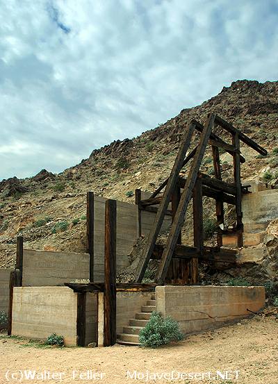
Salt Spring/Amargosa mine
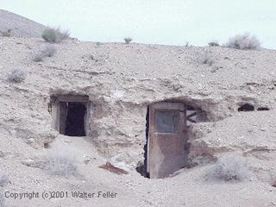
Darwin, Ca.