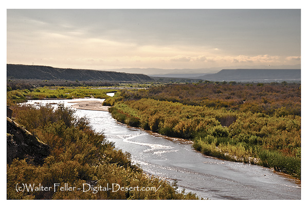
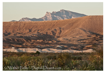
The Adams (Virgin) River
At night Manuel one of my men ran off taking with him a horse Rifle and ammunition belonging to the Comp. The two snake women that I had purchased from the Utas to save them from the torture also ran off with him. This was undoubtedly by his instigation as he could talk with them which neither of my men could do he probably told them he would take them to their own country. A range of low mts still keeps on the E and on the W the country has the same unwelcome appearance the detached hills are somewhat higher. In the plains are a few antelope and in the Mt some Ibex our dried meat was now gone. In continuing South for 2 days a similar country to the last described. Small streams of water coming out of the Mt on the E are soon lost in the Plain on these creeks there is some grass and Brush. 2 or 3 antelopes killed. Came to a small Creek running S followed it a part of a day but the country becoming verry Rock and hilly I was obliged to turn off to the right where after traveling 8 or 10 miles through a rough country I came to a stream about 60 yds wide running S W and coming from the N E : consequently it must head with Ashleys River.
This river I call Adam's River in honor of the present President. I proceded on down this river and as we found no game or Beaver we had nothing to eat. The grass of the river at this place was of those coarse tough kinds which we call Salt and Cane grass. On the day after I struck the river I passed a small spot of ground where corn had been raised 3 or 4 years since. Some of my men could hardly believe it possible that corn had ever been planted in this lonely country although the remains of the stalks were found. The hills being irregular convinced me that it was the work of Indians. The course of the River which is wide sandy and shallow continues S W and the country off from the River Rough Rocky & Red hills no timber or game. On the evening of the second day I had advanced a little ahead of the company to look for a place to encamp. near a small Creek coming in from the west and at the distance of 200 yards I observed an Indian on a hill and made signs for him to come to me but he presented his bow and arrows and in a moment I saw 15 or 20 appear. not considering it safe to remain here I hastened back to the party and then proceeded on to the selected encampment. By this time 20 or 30 were seen skulking around among the Rocks. I therefore had every thing prepared for the worst and advancing alone before the camp by making signs and speaking in a friendly tone of voice I finally succeeded in persuading one of them to come to me. < Previous - Next >
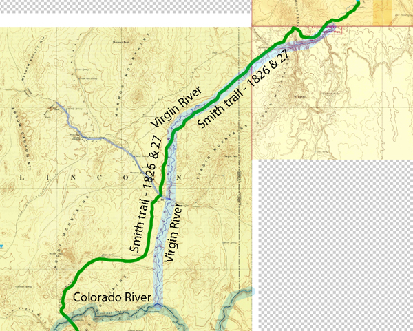
We pick up on Jedediah's journeys across the Mojave Desert along the Virgin River at the mouth of the Beaver Dam Wash southwest of what we know now as St. George Utah.
From SW Utah to Muddy River
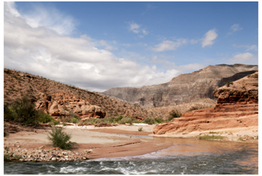
Virgin River
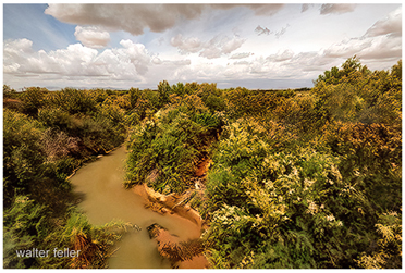
Muddy River
Mormon Mesa