Traditional Territory
The territorial claims of the different ethnic groups who occupied the Mojave and Colorado desert in traditional times in southern California overlap each other, and scholars' descriptions of group boundaries are each of them different. In fact, the boundaries appear to have changed from one time period to another; moreover, groups would sometimes share territory, or a group would invite its neighbors to share an abundant resource.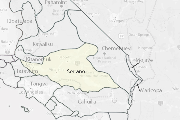
Boundaries at any one time may have been quite specific, even though they can no longer be delineated. Most Southern California elders that Bean has interviewed have been rather specific about where clan territories were located. Boundary markers are commonly referred to i.e. that hill just north of such and such next to such and such as example. Within some areas there were places of common use that were well known to the people who used them, but little such information has survived. (See Francisco Patencio 1943).
<< Contents >> Next >>