Captain Lorenzo Sitgreaves
1811-1888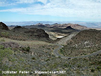 As a lieutenant in the Topographical Engineers, in 1851 Sitgreaves led an exploring expedition over the 35th Parallel Route
from Zuni, New Mexico, to the Colorado River at Yuma.
Sitgreaves Rare Book Library, Washington National Cathedral, Washington D.C.
(Mojave Road Guide, an Adventure through Time - Casebier)
As a lieutenant in the Topographical Engineers, in 1851 Sitgreaves led an exploring expedition over the 35th Parallel Route
from Zuni, New Mexico, to the Colorado River at Yuma.
Sitgreaves Rare Book Library, Washington National Cathedral, Washington D.C.
(Mojave Road Guide, an Adventure through Time - Casebier)
Sitgreaves, an officer in the Corps of Topographical Engineers, was directed to perform a survey of the Zuni and Colorado Rivers by the commanding officer of the Corps, Col. J. J. Abert, on Nov. 18th, 1850. The three-page letter of instructions, signed by Albert, is present here, and directs Sitgreaves to go to Santa Fe "as soon as practicable," find the headwaters of the Zuni, follow it to the Colorado, and thence to the Gulf of California. If the Zuni flows into the Gila, Sitgreaves was to pursue that course to the junction with the Colorado.
Sitgreaves assembled his expedition in the spring and summer of 1851, and departed from the Zuni Pueblo on September 24. They proceeded across northern New Mexico and Arizona, observing the countryside, flora and fauna, and Indian inhabitants in detail, passing roughly along the present path of route 66 and Interstate 40. On November 9 the party reached the Colorado River. William H. Goetzmann says of the expedition in his 'Exploration and Empire,' "The Sitgreaves Expedition, which also made significant contributions to archeology and ethnology, marched along the Zuni and the Little Colorado westward across Arizona, past the San Francisco Mountains, to the Mojave Villages on the main Colorado.
"Despite the presence of the skilled mountain man guide Antoine Leroux, the group ran afoul of Indians and suffered a number of casualties, including Leroux himself, who was so badly wounded by a Yampais arrow that he was eventually unable to function as guide...not only was the country rough and the water scarce, but the Indians were decidely hostile". The manuscript of Sitgreaves' account gives a brief summation of the activities of the party up to their departure from Zuni, a day-by-day diary of their progress across New Mexico and Arizona, and a summation of their trip down the Colorado to Ft. Yuma, which they reached on November 30.
In September, 1851, Captain Lorenzo Sitgreaves of the Topographical Engineers continued the reconnaissance of New Mexico. Seeking the westward wagon road that Simpson believed feasible from Albuquerque to the Colorado and perhaps all the way to Los Angeles, Sitgreaves, Lieutenant John G. Parke, Richard Kern, and an infantry escort went around the San Francisco Mountains and across the great Colorado River to California. With nineteen years of service, thirteen of them in the Topographical Engineers, Sitgreaves made a good teacher for Parke, also a topog but in the West for the first time. Although harrassed by Mohave and Yuma warriors, the party reconnoitered the slightly known country between Canyon de Chelly and the Colorado. Sitgreaves disliked the Southwest even more than Simpson and, in his twenty-page report, summed up the 250-mile expanse between Bill Williams Mountain and San Diego in a single sentence: "The whole country traversed from the San Francisco mountains was barren and devoid of interest."
from - NPS