Lane Versus Andrews
Huntington's Station
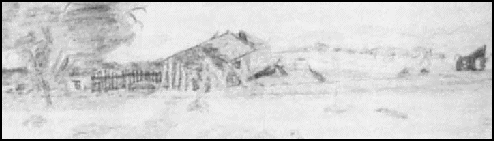
In December of 1872 McKenney and Taylor sold their ranch to J. C. Farley and William Aitken. The sale may have been prompted by the loss of McKenneys son, who had died from typhoid the month prior to the transaction.Just a few months later in August 1873, another death occurred at the station, that of co-owner J. C. Farley. Aitken subsequently gave up the station, and it passed into the hands of Heber Huntington, who made a major change in its operation. McKenney had provided fresh horses for the stages, blacksmithing services and meals, whereas Huntington established a trading post, supplying "provisions and ammunition," besides offering the previous services.
"History of Victor District," Courtesy of San Bernardino Archives.
"THE FIRST TRADING POST"
1917 ILLUSTRATION OF THE HUNTINGTON STATION
Huntington owned the station for several years before selling it to Frederick Audrey Bishop in May 1878. It was resold just two months later to Samuel Rogers, who operated it for the next six or seven years, although the area remained known as Huntingtons Station until the name was changed to Victor in 1885 when the railroad was completed.
Rogers relocated to a site nearer the upper narrows, and began a new station there. Its location, as well as that of other structures in the area of the future town of Victor, is shown in the sketch below, which was used in a lawsuit involving Rogers.
1884 Sketch Map of Victorville
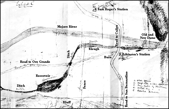
RIGHT PORTION OF THE SKETCH MAP FROM THE 1884 HARTMAN V ROGERS LAWSUIT. THE IDENTIFYING NAMES HAVE BEEN TYPED IN BECAUSE THE ORIGINAL SCRIPT IS HARD TO READ. THE ROAD HEADING NORTHERLY TO CALICO IS THE STODDARD WELLS ROUTE, WHICH CROSSED THE RIVER APPROXIMATELY AT TODAY'S INTERSECTION OF SIXTH AND D STREETS IN VICTORVILLE. REGRETTABLY THE SKETCH DOES NOT INCLUDE HUNTINGTON'S STATION. IT WAS NOT PART OF THE SUIT, BEING LOCATED ABOUT A MILE DOWNSTREAM OF ROGER'S STATION. REMNANTS OF THE DITCHES STILL EXIST, TRAVERSING WHAT WOULD LATER BECOME "OLD TOWN" AND CONTINUING ON DOWN PAST THE PRESENT-DAY CEMENT PLANT. OFF TO THE LEFT OF THE MAP, NOT SHOWN HERE, IS FARMLAND, SUCH AS CORN AND BARLEY FIELDS.
< Previous - Next >
-=-